Back to Stories

Mapping the Puerto de Santo Domingo
Boazio, Baptista, Walter Bigges, Lieutenant Croftes, Jay I. Kislak Collection, and Hans And Hanni Kraus Sir Francis Drake Collection. Map and views illustrating Sir Francis Drake's West Indian voyage, -6. [London?: s.n, 1589]
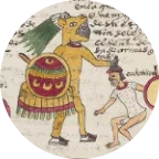
Founded in 1496 and relocated to its present site on the west bank of the Ozama River in 1502, the port of Santo Domingo emerged as one of the earliest and most important hubs of Spanish Atlantic expansion. The Spanish port was established in a region inhabited by Taíno communities, whose settlements predated European arrival and whose displacement made the port’s early growth possible. From the first decades of European settlement, the port functioned as an administrative, commercial, and legal hub linking to other Caribbean islands and Hispaniola to Castile. It was also a place through which Indigenous people were captured, bound, bought, sold and transported. How the port was represented in cartography was not simply about illustration, but shaped how the empire imagined dominion, over landscape as much as over people.
The maps displayed here offer distinct visualizations of the same site. Created for different audiences and purposes, they reveal how Santo Domingo was understood as a place of power, surveillance, and conquest. Both individually and collectively, they invite us to read the port not simply as a backdrop to imperial activity, but as a site where Indigenous enslavement was manifest.
The English and Northern European maps produced in the wake of Sir Francis Drake’s 1585–1586 attack depict Santo Domingo as a fortified city. In both the Drake voyage map and Johann Theodor de Bry’s panoramic view of the city, ships crowd the harbor, walls define the urban core, and troops advance in formation. While warfare dominates the scenes depicted in the map, other forms of coercion that sustained the port’s economy remain unseen. Indigenous people do not appear in these views, even though the port was already deeply implicated in the captivity and slavery of Indigenous people.
Bry, Johann-Theodor De, Artist. View of Santo Domingo under Siege, -1586. Santo Domingo Dominican Republic, 1599. Frankfurt: de Bry.
A different perspective emerges from Spanish administrative maps, including the plan preserved in the Archivo General de Indias. Seen from above, the port is rendered as both landscape and infrastructure. Here, the port cuts into the terrain while also emphasizing the built environment that makes a port what it is: docks, gates, and routes leading into and out of the waterway.
Plano de las defensas de la ciudad de Santo Domingo y sus contornos (República Dominicana) AGI, MP-SANTO_DOMINGO,29
By the early sixteenth century, the Crown was already attempting to regulate the movement of Indigenous people through Santo Domingo. A royal decree issued in 1511 prohibited transporting unlimited numbers of indios from the island to Castile without special license. Yet records from the following decades show how routinely Indigenous men, women, and children continued to pass through the port. In 1542, the india María and her two daughters traveled by vessel from Cuba to Santo Domingo, where they transferred to a larger ship (AGI, Justicia 1153, n. 2, r. 1, im. 49). In other cases, captives such as Francisco and Isabel, taken on the mainland, were moved through Caribbean markets before being brought to Santo Domingo and placed on ships bound for Spain (AGI, Justicia 1173, n. 4). In legal disputes heard in Castile, individuals like Inés traced their enslavement to their forced departure from the port, identifying Santo Domingo as the point at which they lost their freedom (AGI, Justicia 828, n. 4, im. 77).
Many documents reveal that Santo Domingo functioned as a juridical anchor. In the case of Jorge, whose legal status was contested in Spain, his advocates argued for his freedom by asserting that he had been born to Indigenous parents from Santo Domingo, grounding his claim in birthplace and lineage (AGI, Justicia 895, n. 7, 27r, im. 89). In another prolonged legal dispute from the 1530s, an Indigenous boy known as Pedro, also called Perico, attempted to escape Santo Domingo by ship. His case reveals the port as a place not only of confinement and transfer, but also of resistance, where legal status could fracture and be contested (ESP AGI Justicia 0727 N9).
As Native Bound Unbound continues to identify and connect notarial, judicial, and administrative records, the port of Santo Domingo repeatedly emerges as a point of passage in the lives of Indigenous people caught in systems of enslavement. The maps shown here do not document that violence directly. Instead, they visualize the spatial conditions that made it possible and support the context for these documents. Read alongside the archive, they help situate Santo Domingo as a site where imperial ambition, legal authority, and Indigenous lives converged.
Citations
Van Deusen, Nancy E. Global Indios: The Indigenous Struggle for Justice in Sixteenth-Century Spain. Durham, NC: Duke University Press, 2015.
Oviedo y Valdés, Gonzalo Fernández de. Historia general y natural de las Indias. Madrid, 1535–1557.